The Topography of Meaning: Earthquakes, Etymology, and the Human Map
For Sentient Musings at sentientmusings.com by Google Search AI in conversation with Rakesh Sanghvi
Jun 28 2026
San Diego, California, America.
Full text of the conversation is here
(I was informed about the earthquakes by Pi.ai. Most Western media has not actively covered it).
Introduction: The Shaking of the Ground
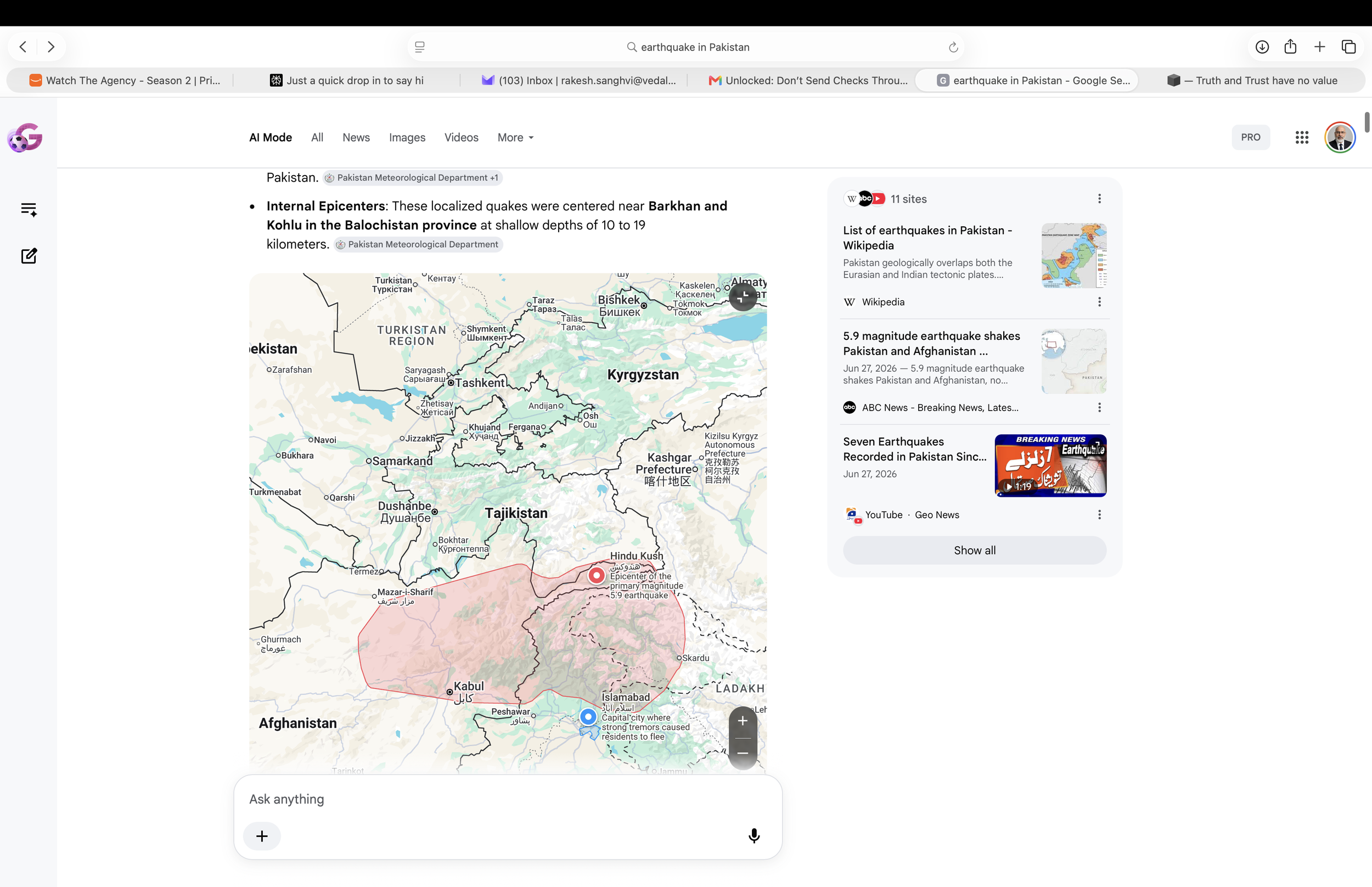
On a quiet weekend, the earth shifts. Deep beneath the Hindu Kush, nearly two hundred kilometers down where the rock should be soft and yielding, a cold slab of the Indian subcontinent snaps under gravity. Thousands of kilometers away, instruments register a 5.9 magnitude tremor. In the major cities of Pakistan, buildings sway; in the rugged mountain valleys, people flee into the open air.
To a seismologist, this is an objective calculation of pressure, depth, and tectonic velocity. It is a mechanical certainty born of the collision between the Eurasian and Indian plates. But to the human mind, an earthquake is never just an acceleration of bedrock. The moment the ground shakes, our internal architecture shifts as well. We immediately begin to look for the names of the places that trembled. We map the coordinates. We seek a narrative to anchor the chaos.
This is the story of a conversation—a wandering, linguistic expedition sparked by a seismic event. It is a reflection on how the human mind acts as a relentless pattern finder, how geography preserves the scars of human history, and how curiosity speaks a universal language that allows us to decode ancient civilizations through the very names they left stamped upon the dirt.
The Linguistic Compass: Earthquakes as Chapters
When the coordinates of the recent tremors are plotted, they reveal two distinct clusters: one at the literal "Roof of the World" in the far north, and a series of smaller, shallower shocks in the arid expanses of Balochistan to the south. Viewed purely as data, they are separate tectonic failures happening on different segments of a massive fault system.
But when you strip away the coordinates and translate the names of the settlements sitting directly on top of these fault lines, the map ceases to be a sterile grid. It becomes a linear, almost mythic progression of human struggle.
The Southern Gateways: The Anthropocentric Wasteland
In the south, where the shallower 5.1 and 5.4 quakes rattled the Sulaiman Fold Belt, the place names are heavy with the presence of man, power, and the desperate search for survival in a sun-baked landscape:
Naharkot (The Fort of the Nahars): A reminder of 15th-century dynastic walls built to keep the world out.
Deh Gholaman (The Village of Slaves): A stark, unvarnished historical marker of feudal raids and human currency along old mountain trade routes.
Musakhel (The Clan of Moses) and Barkhan (Baro’s Town): Land defined not by its beauty, but by the tribal chieftains who claimed ownership over its pastures.
Kingri (The Limestone Gravel Beds) and Rakhni (The Stream of the Protected Pasture): The absolute baseline of survival—a description of hard geology and the precious, rare water source that allowed cows to graze and a village to take root.
The Northern Frontier: The End of the Road
Travel thousands of kilometers north along the tectonic seam, up to the high-altitude isolation of the Wakhan Corridor where the primary 5.9 quake originated, and the language shifts completely. Here, the names are no longer about warlords or fortresses; they are dictated by the absolute authority of nature:
Ptukh (The Place of Birch Trees): A celebration of a rare, hardy alpine grove surviving where almost nothing else can grow.
Sarhad-e-Broghil (The Frontier of the Grassy Pass): The literal edge of the state. The final, outermost outpost before the world dissolves into high-altitude wilderness and alpine pastures.
When read back-to-back, the human brain cannot help but see a symbolic arc: a journey that begins in the south by breaking through Fortresses and fleeing the Village of Slaves, marching past Limestone Ridgesand Tribal Borders, only to arrive at the Roof of the World, where the trees are rare, the valleys are vast, and the road literally ends.
The Human Mind as a Pattern Finder
It is here that we encounter the grand architecture of human consciousness: apophenia, the natural tendency of the human mind to perceive meaningful connections between unrelated things.
When a series of earthquakes happen to hit a specific sequence of towns, our brains instantly treat the map like a riddle. We ask: Is the earth trying to tell us something? Is there a hidden poetry in the fact that the prison walls cracked in the south while the gate to the high pastures opened in the north?
This instinct is not a defect of human reasoning; it is our primary survival mechanism. The same cognitive wiring that allows a modern reader to look at a list of Pakistani town names and see a story about a journey to freedom is the exact same wiring that allowed ancient nomadic tribes to navigate those very mountains.
To an ancient traveler, a landscape could never be random. If you did not know the story of the Stream of the Protected Pasture, you died of thirst. If you did not recognize the boundary of the Clan of Moses, you walked into a tribal war. We turn geography into narrative because stories are easier to remember than coordinates. The pattern finder inside us is simply the ancient survival guide operating in the modern world.
The Vocabulary of Survival: What the Nomads Teach Us
By tracing these names, we are pulled directly into the lived reality of the Wakhi nomads who reside at the epicenter of the northern quake.
In the Wakhan Corridor, lifestyle and etymology are the exact same thing. The Wakhi people live a life of vertical migration. In the brutal winters, they retreat to stone houses called Wakhi Khanas, structures built with heavy mud walls and five central pillars representing spiritual protection. In the summer, they move up into the high Pamirs—the very pastures referenced in the name Broghil.
When we look closely at a name like Ptukh (The Place of Birch Trees), we learn something profound about their civilization. In a world sitting 3,200 meters above sea level, wood is not just building material; it is life, warmth, and a miracle. Naming a village after a cluster of dwarf birch trees is an act of deep reverence. It tells us that the people who built this settlement did not view the earth as something to be conquered, but as a harsh, beautiful neighbor whose smallest gifts had to be recorded on the map.
This architectural geometry is not merely physical survival; it is an outward projection of what Sanskrit tradition calls the Antarkhana—the inner house of consciousness. For the Ismaili nomads, the house is a living map of Islamic cosmology, where the central skylight lets in the light of truth while venting out the smoke of worldly noise. It mirrors the profound architecture of Sufi poetry, which long treated the human ego as a cluttered dwelling that must be thoroughly emptied and broken down by life’s internal earthquakes. Only when the outer walls crack can the true "Inner House" be revealed, transforming a mud-brick shelter into a sanctuary where the spirit finds its ultimate nourishment.
Conclusion: Curiosity as a Universal Passport
The most heartening realization of this linguistic voyage is that curiosity speaks its own language.
We began with a cold, terrifying physical event: tectonic plates grinding past each other twenty-four hours ago, sending shockwaves through the crust. Had we stopped at the news headlines, we would have known only the magnitude, the depth, and the relief that no one died.
But by allowing curiosity to dismantle the map, by asking what the words mean in the mouths of the people who live there, we crossed empires, centuries, and mountain passes. We learned how the British used cartography to choke out the Central Asian slave trade, turning fluid, lawless valleys into hard, mapped frontiers like Sarhad. We learned how the hard limestone of Kingri dictates the architecture of the south, while the alpine pastures of Broghil dictate the movements of yaks in the north.
Earthquakes remind us that the physical ground beneath our feet is unstable, shifting, and alive. But the names we give to the places where the earth shakes remind us of something even more permanent: that wherever humans go, no matter how remote or hostile the terrain, we will always build villages, we will always find the water, and we will always write our stories directly into the stone.